Independence Avenue, SW: Temporary Travel Lane and Sidewalk Closures

(Washington, DC) –DC Water’s contractor on the Potomac River Tunnel Project will continue potholing operations along Independence Avenue, SW between Ohio Drive and West Basin Drive on or about April 15 – 17, 2024, weather permitting. This work requires the temporary closure of one eastbound travel lane, one westbound travel lane, and the portion of the sidewalk adjacent to West Potomac Park along Independence Avenue during work hours. Please refer to Maps A, B, and C for additional details.
Potholing is a method for investigating the locations of underground utilities. The road will be restored when the investigation work is completed. Potholing is necessary to prepare the site for constructing the Potomac River Tunnel (PRT).
Independence Avenue, SW Work (Maps A, B, & C)
- Date: April 15 – April 17, 2024, weather permitting
- Time: Monday – Wednesday from 9:30 am – 2:30 pm
- Location: Independence Avenue, SW between Ohio Drive and West Basin Drive
- Traffic Patterns and Pedestrian Detours:
- Traffic: Temporary lane closures on portions of Independence Avenue, SW between Ohio Drive and West Basin Drive, and on the eastbound and westbound travel lanes.
- Pedestrian Detours: Temporary sidewalk closures adjacent to West Potomac Park between Independence Avenue, SW, and West Basin Drive, SW.
- Traffic: Temporary lane closures on portions of Independence Avenue, SW between Ohio Drive and West Basin Drive, and on the eastbound and westbound travel lanes.
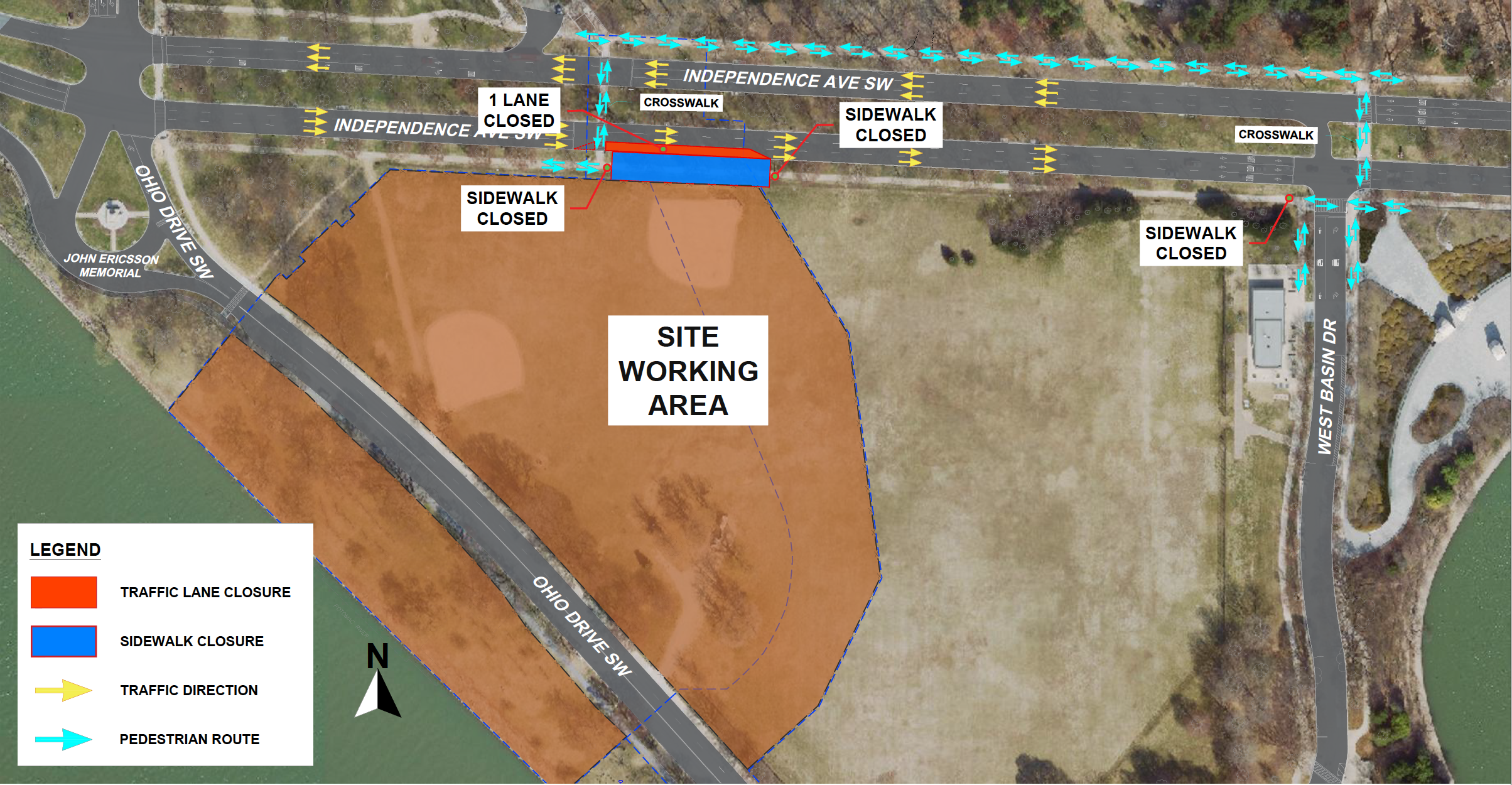
Map A: (Independence Ave, SW) Potholing – April 15th.
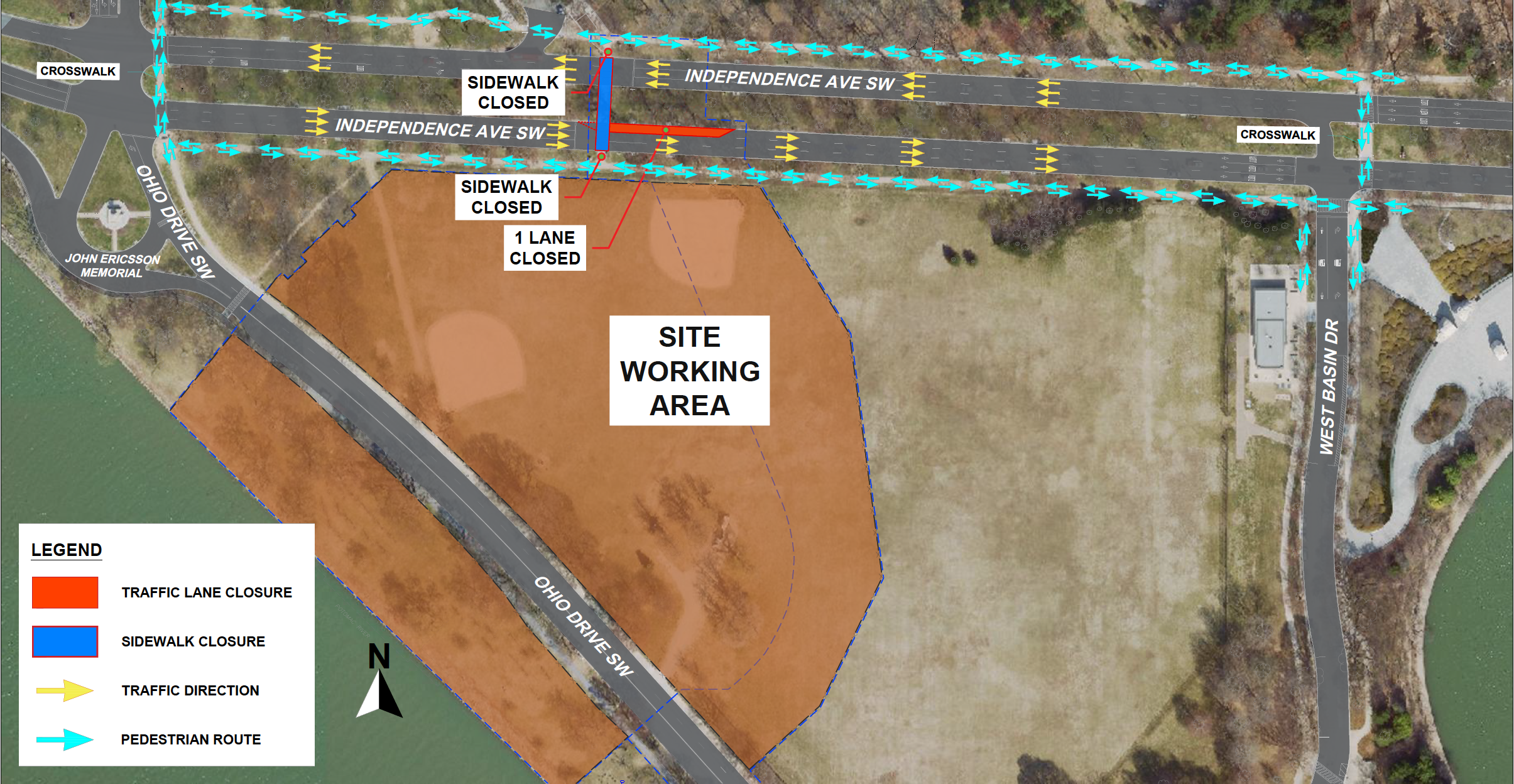
Map B: (Independence Ave, SW) Potholing – April 16th
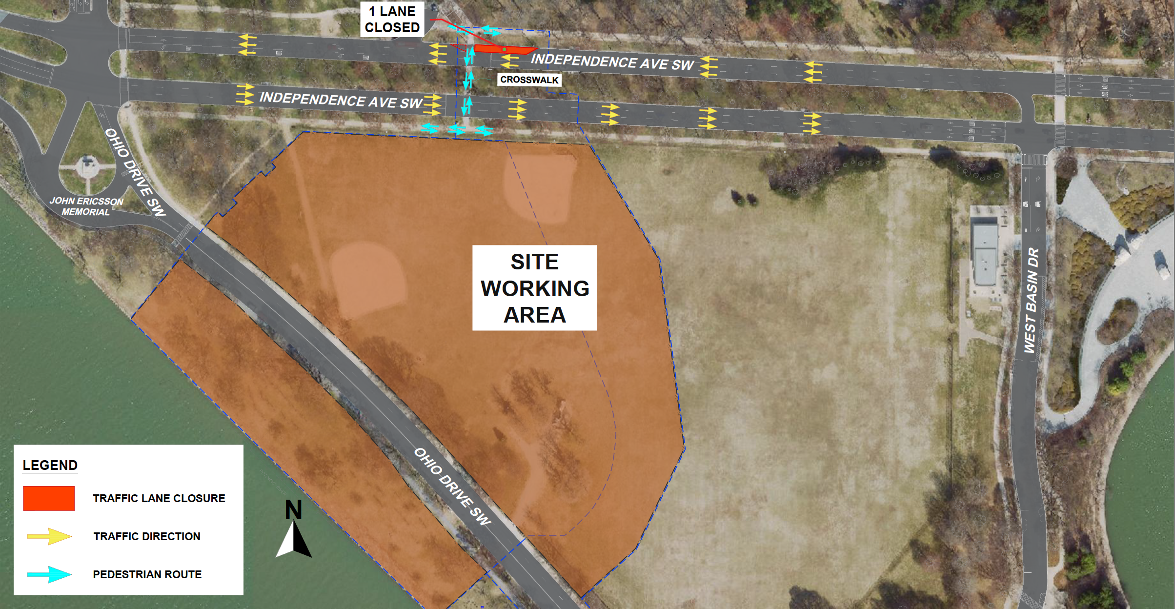
Map C: (Independence Ave, SW) Potholing – April 17th
Important Information
- Commuters and pedestrians will notice road signs/and flagging personnel directing them through the temporary closures.
- Please plan your travel routes accordingly and anticipate potential delays. Traffic control measures will be in place to guide motorists safely through the area.
- Alternative pedestrian routes will be provided, and signage will be posted to direct pedestrians to safe pathways. Refer to the illustrations above for additional details.
Project Details
The Potomac River Tunnel is the next major phase of the DC Clean Rivers Project. The project consists of a large-diameter deep sewer tunnel, diversion facilities, drop shafts, and support structures to capture flows from existing combined sewer overflows (CSOs) along the Potomac River and convey them to the Blue Plains Advanced Wastewater Treatment Plant. The project is needed to reduce CSOs that contribute to water quality impairment of the Potomac River and ultimately the Chesapeake Bay; and to comply with the 2005 Federal Consent Decree entered by DC Water, the District of Columbia, the US Environmental Protection Agency, and the US Department of Justice, as amended in January 2016.
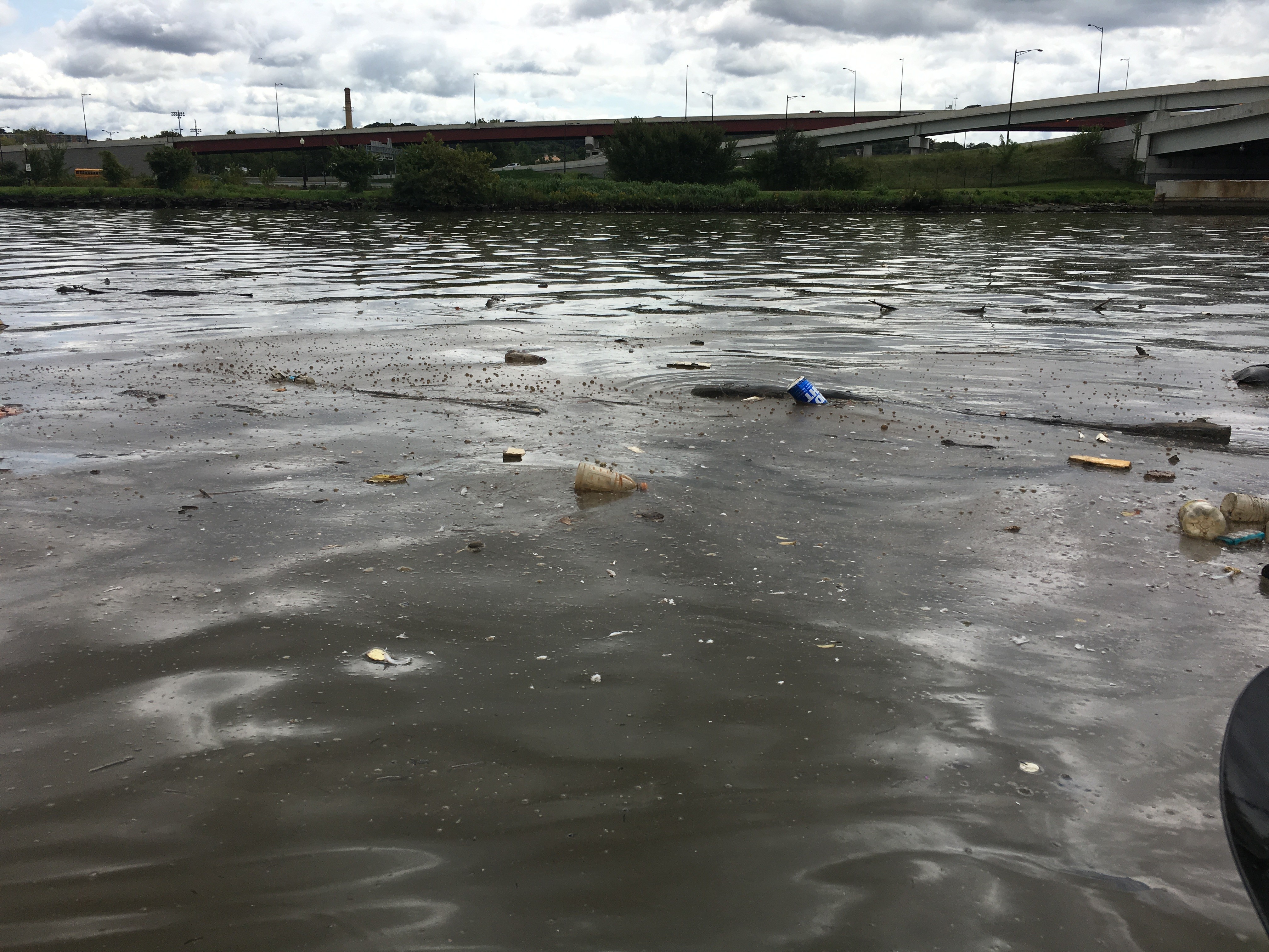
CSOs are released into the Potomac River from CSO Outfalls during rainfalls that exceed the system's capacity. CSOs impair water quality by increasing water bacteria levels, contributing to low dissolved oxygen impacting aquatic life, and increasing the amount of trash in waterways. An estimated 654 million gallons of CSOs currently enter the Potomac River in a year of average rainfall. The proposed controls are estimated to reduce the volume of CSOs to the Potomac River by 93% and reduce their frequency from approximately 74 events to 4 events in a year of average rainfall.
For more information
Project Email: dcpotomacrivertunnel@dcwater.com
Project Website: www.dcwater.com/prt
DC Water 24-hour Emergency: 202-612-3400